![]() thehs2
thehs2
these web pages
are being produced by
Barry Cornelius

home
London to WestMids
Phase 1
maps
locations
KMLs
WestMids to Crewe
Phase 2a
maps
KMLs
official DfT data
Crewe to MCR
WestMids to Leeds
Phase 2b - 2016
maps
KMLs
official DfT data
Phase 2b - 2013
maps
KMLs
official DfT data
Other web pages
what is the HS2?
links
tweets
contact
privacy
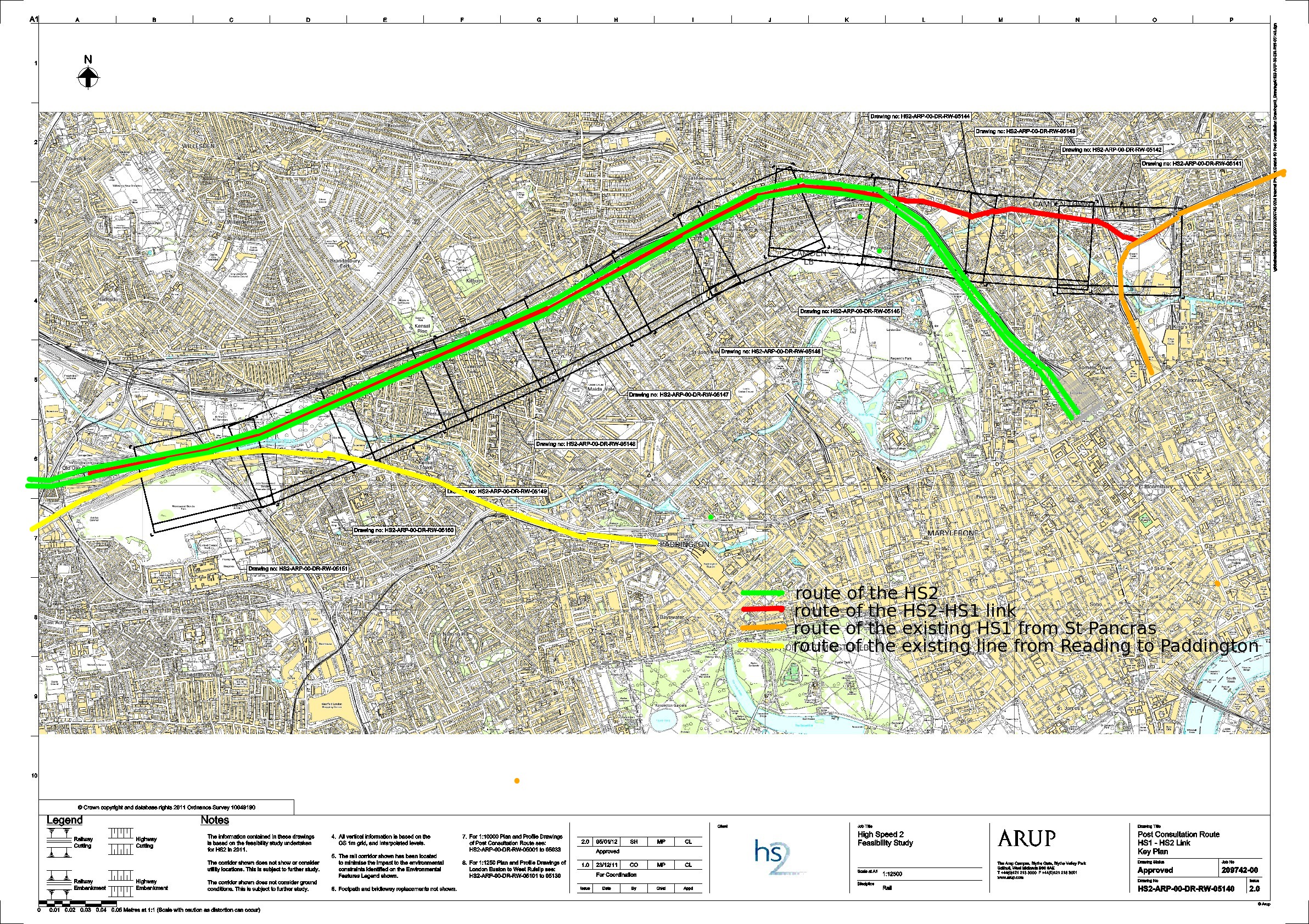
The HS2-HS1 link
Here is an image showing a map of the link between the proposed HS2 and the HS1. If you click on the image and then click again, you can see a larger image.
The link is mainly in a tunnel. In the east, the link joins the HS1 at a junction that is north of London St Pancras. And it extends westwards as far as Old Oak Common, which is where the link has connections to the HS2. So, for much of the route, the link is in a tunnel that is in between the two tunnels of the two lines of the HS2.
I've annotated the image with coloured lines. These annotations show my understanding of the intentions. So the annotations may be wrong. Also, the lines I've drawn are likely to be inaccurately placed.
- green: route of the proposed HS2
- red: route of the proposed HS2-HS1 link
- orange: route of the existing HS1 from St Pancras
- yellow: route of the existing line from Reading to Paddington
Credits
There's a Department for Transport web site that provides maps of the route of the proposed HS2. In particular, it provides a PDF that has a map showing the proposed HS2-HS1 link. The map on this page has been derived from that PDF.